ISRO adds another feat, successfully launches its sixth navigation satellite.
The Indian Space Research Organization-ISRO on Thursday accomplished the penultimate step in developing the country’s own navigation system with the textbook launch of IRNSS navigation satellite.
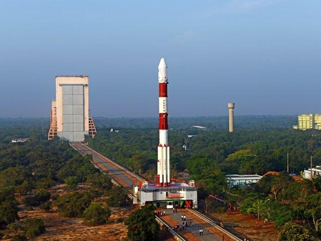
Satellite Launch Vehicle (PSLV) C32 on carrying the 1,425kg IRNSS (Indian Regional Navigation Satellite System) lifted off from the second launch pad at the Satish Dhawan Space Centre in Sriharikota at 4.01pm. ISRO delayed the launch by one minute to avoid a possible collision with space debris. Around 20 minutes after liftoff, PSLV C32 successfully placed IRNSS-1F in orbit. Mission director Jaykumar B announced the satellite placed safely in the orbit.
IRNSS-1F is the sixth of seven satellites that would form a constellation of India’s own navigation satellite network. The satellite will take ISRO to the threshold of putting in place an independent regional navigation satellite system like the American Global Positioning System (GPS).The regional navigation system will provide accurate positional information to users in India and up to 1,500km from the boundary.
IRNSS will provide two types of services – standard positioning service for all users and restricted service, which is an encrypted service only for authorized users. An ISRO spokesperson said the first five satellites of the IRNSS have started functioning and have an accuracy of less than 20 metres. Users and authorities rely on Google maps for positioning, locating and navigation.
After success in this mission, country will have its own positioning system which will lessen dependence on Google or other sources to locate. ISRO will launch the seventh IRNSS satellite in April which will further improve the position of the objects.
Elive Today heartily congratulates ISRO for success in its mission and wish for further success in the final mission accomplished.
 Currency Convertor
 Post an article
 Covid19 Updates
 Elive Today.
 sending...