Breaking News




Popular News





Enter your email address below and subscribe to our newsletter
 By Mohit Kumar Nirwan
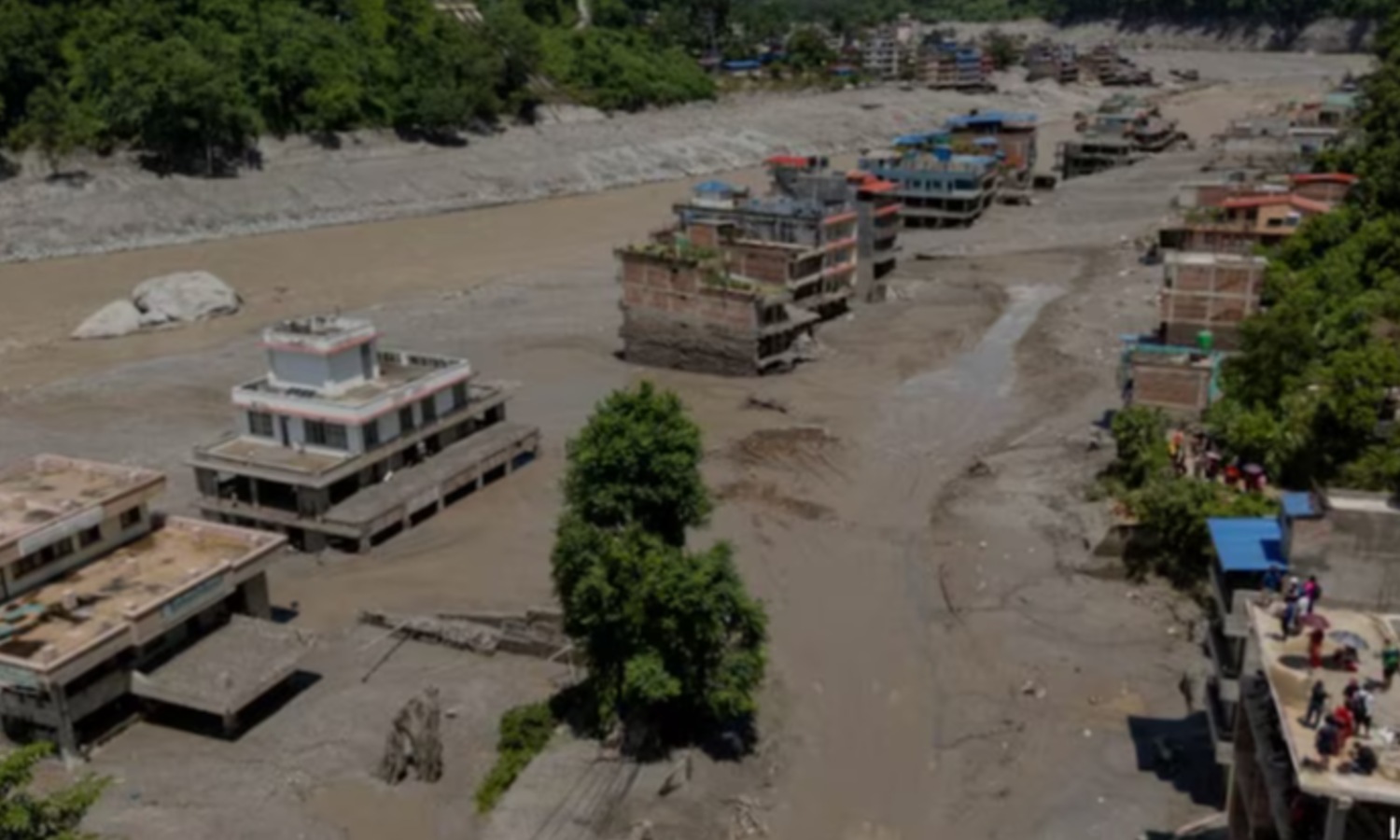
The disaster unfolded around 8:30 AM to 9:00 AM local time on August 26, 2026. Within half an hour, water levels along sections of the Trishuli River spiked by nearly 9 meters (27 feet), swallowing entire settlements, custom offices, and border infrastructure.
Loss of Life and Missing Persons: The casualty toll has climbed rapidly.
Impacted Areas: Border settlements such as Timure and Syabrubesi took the direct impact, followed by downstream towns like Betrawati, Trishuli Bazaar, and Galchhi.
Critical Infrastructure Damage: Over 35 motorable bridges were destroyed, and a 42-kilometer stretch of the main road connecting Kathmandu to the Rasuwagadhi border crossing with China was entirely washed out.
Initial confusion led early reports to attribute the disaster to a magnitude 4.4 earthquake.
Glacier Collapse and Avalanche: At an elevation exceeding 5,000 meters, a massive mass of glacier ice and rock broke away from a mountain peak and plummeted over a kilometer vertically into the valley floor.
Damming and Rapid Breach: The avalanche deposited millions of tons of debris into the upper Lhende River, temporarily blocking the water flow. Within moments, the trapped meltwater built up behind the temporary debris dam until it breached, sending a high-velocity surge of water, rock, and mud roaring down the narrow river valley.
Permafrost Thawing: Climate researchers highlight that while the trigger was a slope collapse, the underlying cause is the degradation of high-altitude permafrost—the frozen ground that acts as binding glue for Himalayan mountain faces.
Flash floods stemming from high-altitude avalanches and glacial lake breaches are an inherent risk in the geologically young Hindu Kush Himalayan region, but their frequency and magnitude have escalated rapidly in recent years.
Seti River Disaster (2012): A sudden rockfall and ice avalanche near Pokhara, Nepal, swept away downstream villages and killed over 70 people.
Chamoli Disaster, India (2021): A massive rock and ice avalanche triggered devastating flash floods along the Dhauliganga River in Uttarakhand, destroying two hydroelectric projects and claiming over 200 lives.
South Lhonak Outburst, India (2023): A glacial lake outburst in Sikkim breached a hydroelectric dam and flooded the Teesta River valley, causing widespread casualties and infrastructural destruction downstream.
Tibet-Nepal Border Flash Flood (August 2026): The recent glacial collapse stands as one of the deadliest mountain hazards in the region's recent history, demonstrating the extreme vulnerability of river valleys to high-altitude collapses.
Preventing high-altitude glacier collapses is impossible, but reducing the loss of life and mitigating downstream destruction requires immediate structural changes across the Himalayan belt.
Automated Early Warning Systems: High-altitude origins mean flash floods travel downstream within minutes. Developing real-time sensor networks and automated cross-border hydrological data-sharing between China, Nepal, and India can provide downstream communities critical minutes to evacuate.
Climate-Resilient Infrastructure Placement: Hydropower plants, bridges, and highways are frequently built directly in narrow floodplains.
Continuous Satellite Remote Sensing: Remote monitoring of high-risk glaciers, permafrost thaw zones, and glacial lakes needs to be expanded. Satellite monitoring can identify destabilizing slopes long before catastrophic failure occurs.
Community Emergency Preparedness: Settlements living alongside Himalayan rivers need localized siren systems and regular evacuation drills so residents can react instantly when river levels unexpectedly rise.